TYPE:
SENSOR
LAYER:
DS_PHR1B_202403180710011_FR1_PX_E047S19_0202_00670
FORMAT:
DIMAP
RASTER:
image/tiff
General Information
Map Name
Geometric Processing Level
Radiometric Processing Level
BASIC
Image dimensions
Number of columns
4912
Number of rows
14520
Number of spectral bands
1
Dataset framing
Vertice
Longitude (DEG)
Latitude (DEG)
Row
Col
#1
47.10861466489967
-19.07277773787331
#2
47.13200027099712
-19.07286924552021
#3
47.13202055799731
-19.13816947542703
#4
47.10859544381821
-19.13819402072253
Dataset sources
PHR
Coordinate Reference System
Projected Coordinate System
Geocoding tables identification
EPSG(6.3)
Production
Production Date
2024-03-18T20:40:17.151
Job identification
6948198101-1
Dataset Producer Identification
AIRBUS DS GEO
Producer link
http://www.geo-airbusds.com
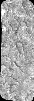
Quicklook
Copyright